The Submerged Peninsula: A Geophysical and Textual Case for the Levantine Location of the First Eden
The Urantia Book places the first Garden of Eden on a peninsula that projected from the eastern Mediterranean and sank beneath the sea. This paper sets out a methodology that separates the revealed text from human inference, then weighs that text against the marine geology of the Levantine Basin, the geophysics of the Sarmast and Bates expeditions, and mainstream Plato scholarship, to assess how well the location claim holds.
Abstract
The Urantia Book makes a geographic claim that looks falsifiable. It states that the first Garden of Eden stood on a long, narrow peninsula projecting westward from the eastern shore of the Mediterranean Sea, that the peninsula was connected to the mainland by a neck only twenty seven miles wide, and that the entire landmass later sank beneath the sea over a span of several hundred years. If that is a real place and a real event, the floor of the far eastern Mediterranean should bear the geological signature of a landmass that subsided, and the broader Mediterranean and Near Eastern memory should carry the trace of a lost garden civilization.
This paper does four things. First, it states a methodology that keeps revealed text and human inference in separate columns, so that the argument never quietly converts a scripture into evidence or a sonar reading into doctrine. Second, it lays out the marine geology of the Levantine Basin and asks whether subsidence on a large scale there is plausible on its own terms. Third, it engages mainstream Plato scholarship honestly, granting the academic reading of Atlantis as allegory before narrowing to a defensible claim. Fourth, it treats the Sarmast and Bates expeditions with full disclosure of their negative and ambiguous results. The conclusion is deliberately modest. The textual location claim is internally coherent and sits in a geologically permissive setting, but no instrument or core has yet confirmed an artificial structure on the basin floor, and honesty requires saying so plainly.
A Note on Method
I would rather hand you a real question than a fake certainty, so the method comes first and stays visible throughout.
The Urantia Book is treated here as a textual source that makes a specific geographic assertion. That assertion is quoted verbatim, with a citation in the form (Paper:Section.Paragraph), and it is never paraphrased into looking more or less confident than the original. Where I quote the revelation, that is what the book says. Where I reason from geology, classics, or the expedition record, that is human inference, and I label it as such.
These two streams are kept apart on purpose. The revealed text cannot be entered as physical evidence in a court of marine geology, because revelation is not how that discipline establishes facts. Equally, a sonar anomaly cannot be entered as confirmation of revelation, because a contested reading of seabed relief proves nothing about a claim fifty thousand years old. What the two streams can do is converge or diverge. If the revealed geography described a place that geology says could never exist, that would count against the claim. If the geology describes a setting in which the revealed event is at least possible, that is a weaker but real form of support. Convergence is encouragement, not proof.
One source requires a specific caution. The chief narrative of the underwater expeditions is a 2023 presentation by Captain Robert Bates, who led the 2004 field season and continued the project that Robert Sarmast originated. That presentation quotes the Urantia Book from memory and from imperfect transcription, and several of its quotations are garbled. I do not quote the revelation through that channel at all. I draw on it only for the geophysical and expedition narrative, the plate setting, the instruments, the silt, the failed camera result, and the geologist's competing explanation, and I flag every such claim as expedition material rather than established science.
The Textual Claim
The Urantia Book's account of how a Garden is sited is procedural, not poetic. A committee surveys candidate locations and reports back. The book lists three finalists.
"The committee on location was absent for almost three years. It reported favorably concerning three possible locations: The first was an island in the Persian Gulf; the second, the river location subsequently occupied as the second garden; the third, a long narrow peninsula, almost an island, projecting westward from the eastern shores of the Mediterranean Sea." (73:3.1)
The third option won.
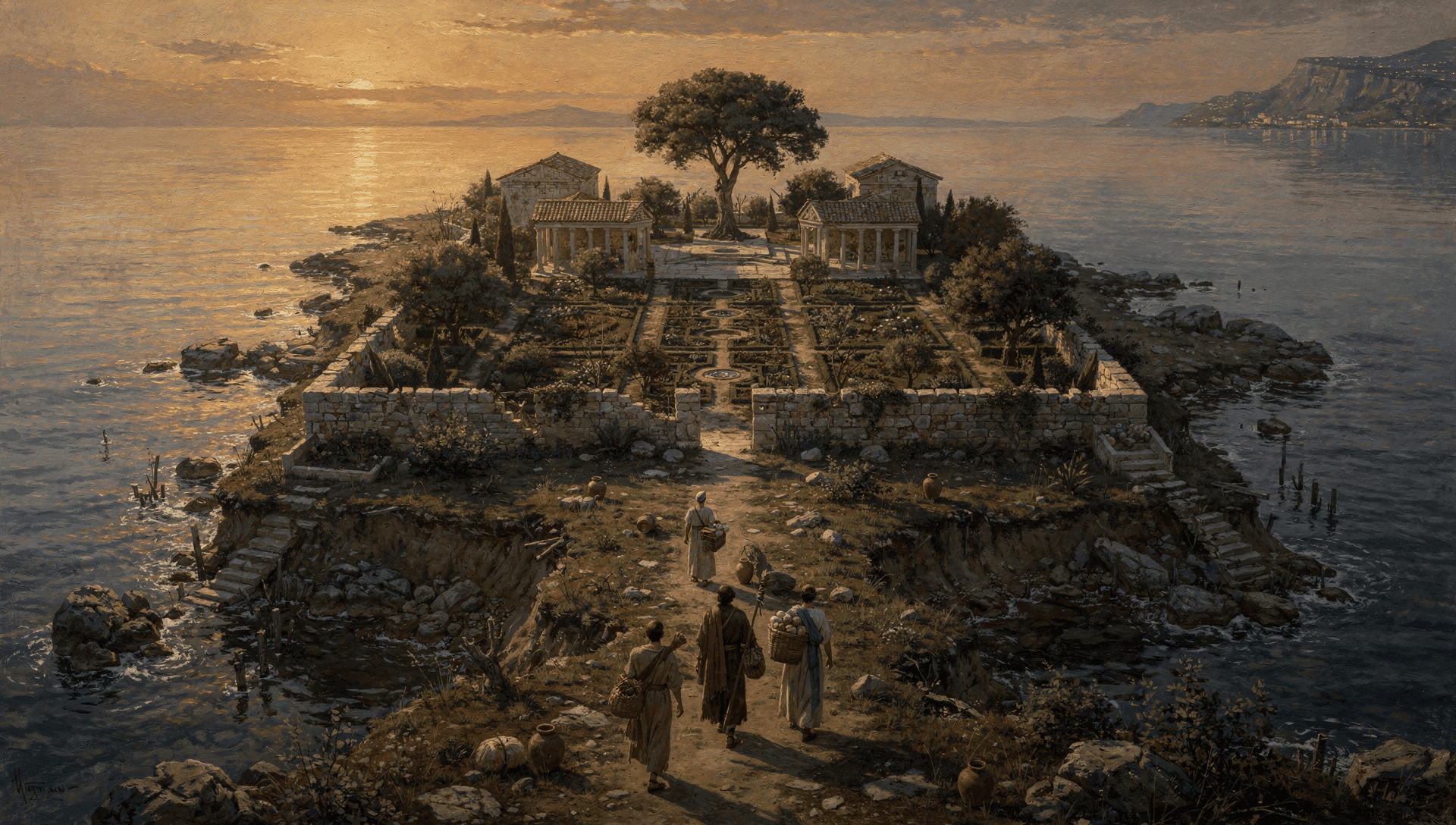
"The committee almost unanimously favored the third selection. This site was chosen, and two years were occupied in transferring the world's cultural headquarters, including the tree of life, to this Mediterranean peninsula. All but a single group of the peninsula dwellers peaceably vacated when Van and his company arrived." (73:3.2)
The text then describes the physical setting in terms that read like a site report. The climate is even, the surrounding mountains trap a stable weather system, and the place behaves like an island within an inland sea.
"This Mediterranean peninsula had a salubrious climate and an equable temperature; this stabilized weather was due to the encircling mountains and to the fact that this area was virtually an island in an inland sea. While it rained copiously on the surrounding highlands, it seldom rained in Eden proper. But each night, from the extensive network of artificial irrigation channels, a "mist would go up" to refresh the vegetation of the Garden." (73:3.3)
Then comes the single most testable sentence in the entire account, because it gives a measurement and a hydrology.
"The coast line of this land mass was considerably elevated, and the neck connecting with the mainland was only twenty-seven miles wide at the narrowest point. The great river that watered the Garden came down from the higher lands of the peninsula and flowed east through the peninsular neck to the mainland and thence across the lowlands of Mesopotamia to the sea beyond. It was fed by four tributaries which took origin in the coastal hills of the Edenic peninsula, and these are the "four heads" of the river which "went out of Eden," and which later became confused with the branches of the rivers surrounding the second garden." (73:3.4)

Two details there deserve emphasis. The neck is given a width, twenty seven miles, which is a number a survey could in principle confirm or refute. And the four tributaries are identified as the original of the "four heads" of Genesis, with the explicit note that the later tradition confused them with the rivers of the second garden in Mesopotamia. The Urantia account is therefore not in competition with the Tigris and Euphrates reading of Genesis. It says that reading is a downstream confusion of two different gardens.
The chronology is fixed elsewhere in the text. Adam and Eve arrived by seraphic transport at a prepared garden.
"ADAM AND EVE arrived on Urantia, from the year A.D. 1934, 37,848 years ago. It was in midseason when the Garden was in the height of bloom that they arrived. At high noon and unannounced, the two seraphic transports, accompanied by the Jerusem personnel intrusted with the transportation of the biologic uplifters to Urantia, settled slowly to the surface of the revolving planet in the vicinity of the temple of the Universal Father." (74:0.1)
That places the garden's active period at roughly thirty eight thousand years ago. The submergence came later, and the book describes it as a slow geological process rather than a sudden catastrophe.
"The peninsula had been overrun by these lower-grade Nodites for almost four thousand years after Adam left the Garden when, in connection with the violent activity of the surrounding volcanoes and the submergence of the Sicilian land bridge to Africa, the eastern floor of the Mediterranean Sea sank, carrying down beneath the waters the whole of the Edenic peninsula. Concomitant with this vast submergence the coast line of the eastern Mediterranean was greatly elevated. And this was the end of the most beautiful natural creation that Urantia has ever harbored. The sinking was not sudden, several hundred years being required completely to submerge the entire peninsula." (73:7.1)
The book is careful to frame this as ordinary geology, not divine punishment.
"We cannot regard this disappearance of the Garden as being in any way a result of the miscarriage of the divine plans or as a result of the mistakes of Adam and Eve. We do not regard the submergence of Eden as anything but a natural occurrence, but it does seem to us that the sinking of the Garden was timed to occur at just about the date of the accumulation of the reserves of the violet race for undertaking the work of rehabilitating the world peoples." (73:7.2)
This is an important point for method. The text itself asks to be read as describing a natural occurrence. It is not claiming a miracle drowned the garden. It is claiming a tectonic event did, which means the claim is open in principle to assessment by tectonics.
The textual claim, then, is compact and specific. A peninsula whose neck measured twenty seven miles projected westward from the eastern Mediterranean coast, near what the book elsewhere associates with the Syrian shore. It carried an advanced installation, the world's cultural headquarters. Its coastline stood elevated. A great river crossed its neck eastward toward Mesopotamia. Over several centuries, the eastern floor of the Mediterranean subsided and carried the whole peninsula under, while the surrounding coastline rose. That is the geography we now take to the geologists.
The Geological Setting of the Levantine Basin
Everything from here forward in this section is human inference and mainstream observation, not revealed text.
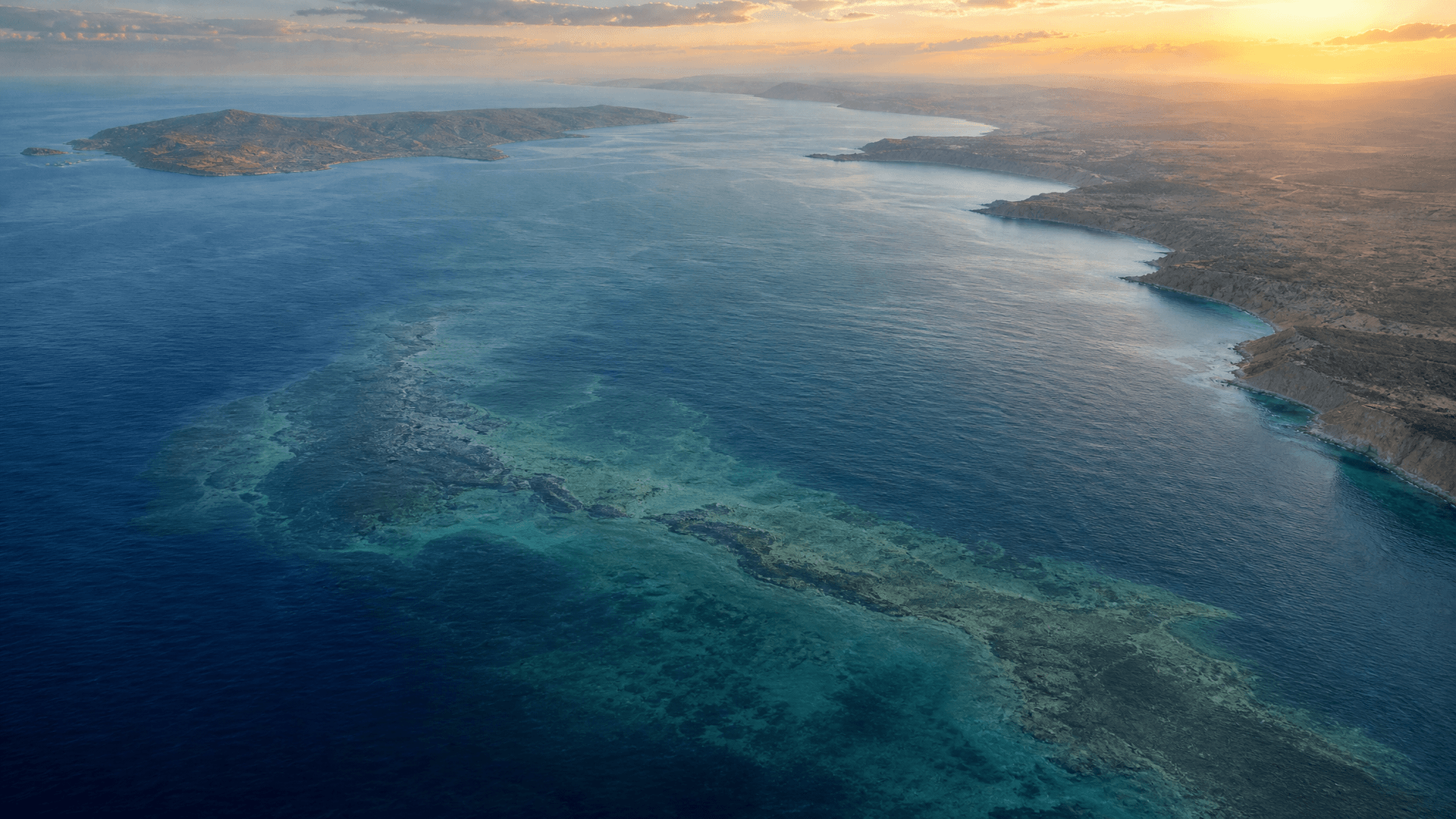
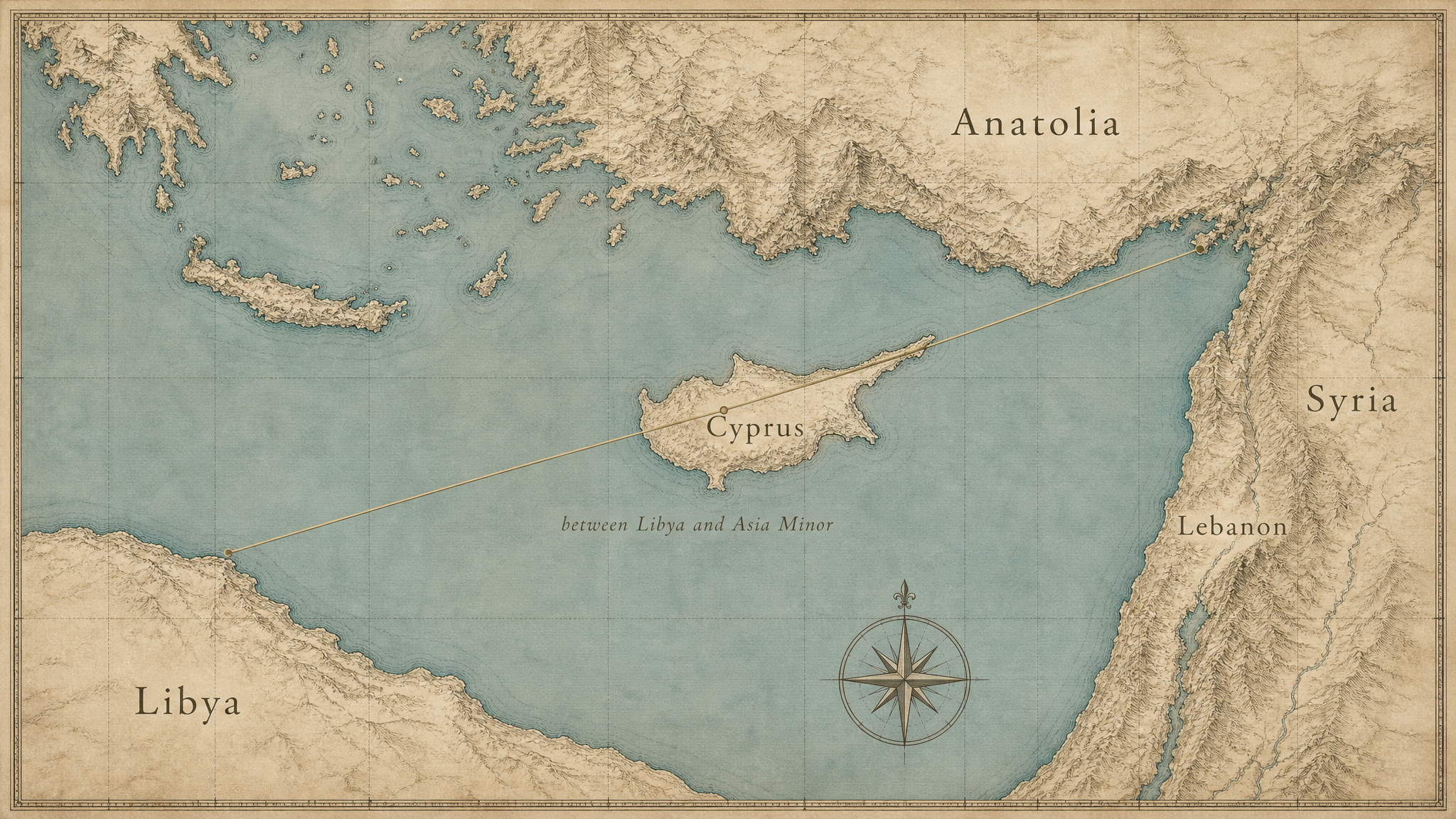
The Levantine Basin is the far eastern compartment of the Mediterranean, lying roughly between Cyprus, Syria, Lebanon, and Israel. It is one of the more tectonically complicated corners of the sea, and that complexity is the strongest part of the geological case, because subsidence on the scale the revelation describes requires an active mechanism.
The basin sits near the meeting of three major plates. The Anatolian plate is being squeezed westward. The Arabian plate is pressing north. The African plate, which underlies the southern and eastern basin, is moving north and subducting beneath the Anatolian margin along the Cyprus arc. This is not exotic geology. The northward push of Africa into Eurasia is the same engine that built the Alps and that keeps the eastern Mediterranean seismically restless. A convergent margin of this kind is exactly the sort of place where the seafloor can rise or fall over geological time as crust is loaded, faulted, and dragged down at the subduction front.
On the expedition's account, this setting provides the subsidence mechanism the revelation needs. Bates describes the African plate carrying the proposed garden site down from an elevation once higher than the land of Syria to roughly one mile below present sea level. That specific figure and that specific reconstruction are the expedition's interpretation, not an independently established fact, and they should be read as a hypothesis about how the documented plate motions could have lowered a block that once stood higher. What can be said with more confidence, from the general geology, is that a downgoing African margin beneath an overriding plate is a credible place to look for the long term subsidence of ground that formerly stood higher.
The region is also rich in salt, and that matters later. During the Messinian Salinity Crisis, around five to six million years ago, the Mediterranean repeatedly desiccated and laid down thick evaporite deposits, including across the Levantine Basin. Those buried salt layers are mobile under load. They flow, dome, and pierce the overlying sediment, producing linear ridges and walls of entirely natural origin. Anyone reading seabed relief in this basin has to reckon with salt tectonics as a competing explanation for straight features, and the expedition's own geologist did exactly that, as discussed below.
Two further facts bear on whether evidence could survive. First, the rise in sea level after the last ice age. At the Last Glacial Maximum, around twenty thousand years ago, global sea level stood well over one hundred meters lower than today, and large stretches of continental shelf around the entire Mediterranean were dry land that later drowned as the ice sheets melted. The archaeology of submerged landscapes is now an established field precisely because so much of the human past lies on drowned coastlines. The eastern Mediterranean has documented submerged prehistoric sites, and the principle that habitable land in this region went underwater is not in dispute. The Urantia chronology places the garden's life well before that rise and its submergence partly overlapping it, so a drowned Edenic landscape is consistent with the broader drowning of the basin's margins, even though the revelation attributes the primary loss to tectonic subsidence rather than to a rise in sea level alone.
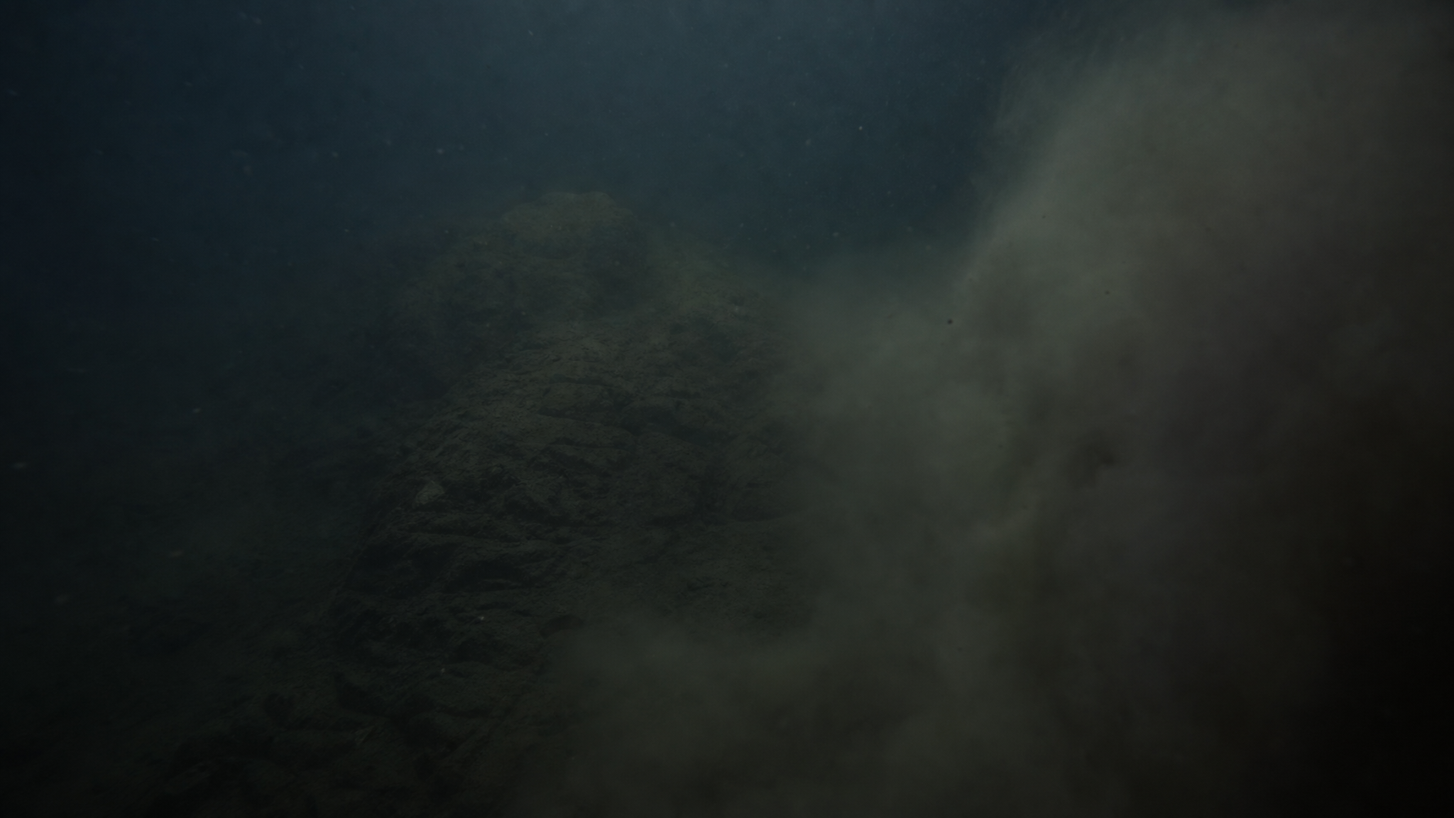
Second, the silt. A national bathymetric survey of the seas around Israel, which the expedition narrative attributes to a researcher it calls Dr. Hall, found the basin floor buried under roughly twelve meters of silt, a blanket about as deep as a five story building is tall. This is the single most consequential fact for the entire question, and it cuts both ways. It means any organic installation that sank thirty odd thousand years ago is buried, degraded, and effectively invisible to surface imaging. It also means that the absence of visible structures on the seabed is the expected condition, not a refutation. A garden is wood, fiber, earthwork, and stone. After thirty thousand years underwater and twelve meters of burial, the wood and fiber are gone and the rest is entombed.
The honest summary of the geology is this. The Levantine Basin is a tectonically active, salt rich, deeply silted subduction setting in which subsidence of ground that once stood higher is plausible and in which the disappearance of evidence is guaranteed. That is a permissive setting for the revealed claim. It is not, by itself, a confirmation of it.
Plato's Atlantis as an Emended Memory
The strongest cultural echo of a lost garden civilization in the western tradition is Plato's Atlantis, and it has to be handled with care, because the mainstream reading is firmly against treating it as history.
Plato tells the Atlantis story in the Timaeus and the Critias, written around 360 BCE. The frame is a chain of transmission. Egyptian priests at Sais told the story to the Athenian lawgiver Solon, who carried it to Greece, where it eventually reached Plato through his family. The tale describes a great power based on an island beyond the Pillars of Heracles, a capital of concentric rings, a maritime empire, a moral decline, and a final destruction in which the island sank beneath the sea in a single grievous day and night.
The dominant scholarly position is that this is philosophical fiction. Pierre Vidal-Naquet, in The Atlantis Story, reads the narrative as a political and moral allegory in the service of Plato's argument about the ideal state, not as a garbled travelogue. A. E. Taylor's commentary on the Timaeus treats the framing as a literary device. Kathryn Morgan's work on myth and philosophy in Plato situates Atlantis among Plato's invented myths, deployed for argument rather than reportage. I take this consensus seriously. The burden of proof is on anyone who wants to read Atlantis as a memory of a real place, and most of the specific machinery of the Critias, the ten kings, the elaborate canals, the numbers, looks like construction rather than recollection.
The defensible claim is narrower than "Atlantis was real." It is this. A literary myth can be built on a real kernel, the way Peter Green observed of early Greek epic that beneath the embroidery there is often a solid stratum of fact. If a genuine submergence event occurred in the right cultural and geographic zone, and if its memory entered the Egyptian and then the Greek stream, then Plato could have inherited a true core and dressed it in invented detail. That is a claim about a seed, not about the whole plant. It does not require that the expedition has found Atlantis, and it explicitly does not claim that.
Within that narrower frame, the expedition offers a textual argument that deserves to be reported clearly and labeled as the expedition's own. Bates applies a method he calls emendation, the critical editing of an ancient text to reverse copying errors accumulated over centuries. He and his collaborator applied it to Plato's account and proposed three corrections. The Greek word nesos can mean both island and peninsula, and the translators chose island, which sent everyone hunting for an island in the open Atlantic. Emended to peninsula, it matches the Edenic geography. The text describing the size of Atlantis may have read meso rather than mega, a change of one letter that turns "greater than Libya and Asia" into "between Libya and Asia Minor," a line that runs across Cyprus. And Plato's "covered" acropolis hill is read not as a hill merely covered over, but as a natural hill artificially flattened by mound builders into a rectangular ceremonial platform.
I want to be exact about the status of these readings. Emendation is a real and respected discipline in classical philology, but it is constrained by manuscript evidence and accepted only when the proposed reading is better supported than the received one. The emendations offered here are not, as far as I can establish, drawn from manuscript variants in the Plato tradition. They are reinterpretations chosen because they make the text fit a prior conclusion, that Atlantis is the first Eden. That is a legitimate hypothesis to state, but it is not the same thing as a philological result, and it should not be presented to readers as if the classics establishment had endorsed it. The honest position is that the nesos ambiguity is genuine and interesting, while the larger emendation program remains the expedition's argument rather than a finding.
The Sumerian, Egyptian, and Hebrew Transmission
The comparative mythology case for a single submerged source memory is developed at length elsewhere in this corpus, so I summarize it here only as it bears on the location claim, and again as inference rather than revelation.
Three adjacent ancient traditions preserve a paradise that is lost or made inaccessible. The Sumerian compositions describe Dilmun, a pure land where sickness and death are unknown. The Egyptian material supplies a paradise garden name that, on the expedition's telling, passes through Solon to Plato. The Hebrew Genesis preserves Eden, a specific garden with a tree of life and four river heads, from which humanity is expelled. The motif of a sunken or lost paradise is not a universal of world mythology. It clusters in the Mediterranean and Near Eastern zone, which is consistent with a shared regional source rather than with independent invention everywhere.
The Urantia Book itself ties the two great submerged sites together in a single sentence that names both the Persian Gulf relic and the Mediterranean one.
"But still older vestiges of the days of Dalamatia exist under the waters of the Persian Gulf, and the first Eden lies submerged under the eastern end of the Mediterranean Sea." (78:7.7)
That is the textual anchor for keeping the two distinct. The Persian Gulf material descends from Dalamatia, the Planetary Prince's earlier headquarters, while the Mediterranean material descends from the first Eden. The structure of two paradises in the myths, a Gulf paradise and a Mediterranean one, maps onto two real and separate submergence sites in the revealed geography. The detail work across traditions, which scholars such as Speiser on Genesis and Crawford on Dilmun have done from the secular side, is treated fully in the companion decoder and is not repeated here.
What matters for the location argument is modest and specific. The transmission case does not prove where the garden was. It shows that the cultures positioned to inherit a memory of a lost eastern Mediterranean paradise did in fact preserve traditions of a lost paradise, and that those traditions cluster geographically where the revealed event is placed. That is convergence of the encouraging kind, not a coordinate.
The Sarmast and Bates Expeditions: What Was Found and What Remains Unconfirmed
This section is where epistemic honesty earns its keep, because the expedition record contains a real negative result and a real natural counter explanation, and a fair account has to lead with them rather than bury them.
The project began with Jacob Malovitsky, an oceanographer who first read the bathymetric scans of this part of the Mediterranean as a sunken continent. Robert Sarmast developed that observation into the thesis that the Levantine Basin floor held a submerged landmass, published it, and mounted two field seasons, in 2004 and 2006. Captain Robert Bates, a career mariner, served on the project and later carried it forward.
The instruments were three. Multibeam bathymetry, much of it supplied by the French marine research agency and processed into three dimensional models, measures depth by sound travel time and produced the maps that guided target selection. Side scan sonar, towed behind the ship in 2004, images the seabed surface to either side of the sensor. A profiler that reads beneath the seafloor, added in 2006, penetrates roughly thirty meters below the seabed to reveal buried layering and denser bodies below the surface. Against the bathymetric maps, the team identified a high point they read as an acropolis or temple hill, a long straight feature with a square corner that they read as a wall, circular features on the summit that they read as temple remains, and a buried anomaly that Bates read as a conduit lined with brick.
The 2004 season was a survey of about three days, funded by roughly four hundred contributors who raised about one hundred seventeen thousand dollars, with sonar support from a commercial team. By the team's own account, only about five to ten percent of the side scan data was usable. The 2006 season, with the sub surface profiler, went badly in the field. A tangled cable on the towed sensor and repeated software failures reduced the run to a single usable track line.
Now the decisive caveats. When a camera, a DT-6000, was lowered to look directly at the hill, it returned essentially nothing. It stirred up the twelve meters of silt, caught one brief glimpse of the seabed before the sediment closed in, and produced no usable image of any structure. There is, at present, no visual confirmation of anything built by human hands on that seabed. That is not a detail to soften. It is the central fact.
And the linear ridges that the team had read as walls were assessed by the project's own geologist, Patrick Lowry of the Scotia Group, as upthrusts of salt in the crust of the seabed, a natural origin entirely consistent with the basin's Messinian salt geology described earlier. In Bates's own candid words, that finding "killed it." Bates has since offered counterarguments. He proposes a model of mound collapse in which an artificially enlarged hill slumped during the sinking, producing a head scarp and toe ridges, and he reinterprets a downward dip in Lowry's cross section as the crushed floor of a buried conduit. These are reinterpretations advanced by an advocate of the thesis. They are not validated results, and independent commentators noted at the time that the features could be underwater volcanic structures or any of countless unknown sites.
There is also no publication reviewed by peers confirming an artificial structure on the Levantine Basin floor, and an explanation from salt tectonics for the most prominent features is on the record from the expedition's own geologist. A responsible reader should hold all of the structural interpretations, the wall, the temples, the conduit, the quarry, as unconfirmed at best and naturally explained at worst.
Why, then, does the expedition still consider the setting worth investigating? Because the negative results are exactly what the revealed claim predicts. If the first Eden sank thirty thousand years ago and lies under twelve meters of silt, then a camera should fail, organic structures should be gone, and surface sonar should return ambiguity. The absence of confirmed structures is the expected condition of a deeply buried, organically built, very old installation. That argument has real force as a defense against premature dismissal. It has no force at all as positive proof, and conflating the two would be the precise error this paper exists to avoid.
The Precise Location and the Two Part Submergence
For readers who want to stand at the spot, the site the expedition kept returning to is the Latakia Ridge, a submerged plateau lying about twenty miles off the Syrian coast in the basin between Cyprus and Syria, with the survey marker near 35 degrees 50 minutes north, 37 degrees 07 minutes east (Sarmast, sunkenpeninsula.com). That is the quarter the revealed text points to. The Urantia Book places the garden on a peninsula "projecting westward from the eastern shores of the Mediterranean Sea" (73:3.1), reached from the mainland by a neck "only twenty-seven miles wide at the narrowest point" (73:3.4). West of the Syrian shore, in the open water toward Cyprus, is where a peninsula projecting westward from that eastern coast would have stood.
The detail worth pausing on is the mechanism of the disappearance, because the revealed account is unusually specific, and it happens to describe the very process that marine geologists invoke for this basin. The text does not say a flood covered the garden. It says the ground itself went down, and that the coast on the far side went up. "The eastern floor of the Mediterranean Sea sank, carrying down beneath the waters the whole of the Edenic peninsula. Concomitant with this vast submergence the coast line of the eastern Mediterranean was greatly elevated" (73:7.1). That is a two part motion, a basin floor subsiding while the neighboring coast rises, which is the signature of the subduction and salt tectonic setting laid out earlier in this paper rather than of a simple inundation. The revelation adds that "the sinking was not sudden, several hundred years being required completely to submerge the entire peninsula" (73:7.1), a gradual settling rather than a catastrophe. None of this proves the case. It does mean that when the text and the geology are set side by side, they describe the same kind of event, in the same place, by the same mechanism, which is the convergence this paper set out to weigh.
What Would Settle the Question
A sober conclusion has to specify what evidence would actually move the needle, in both directions.
The location claim would be strengthened by a small number of concrete findings. A sediment core through the proposed neck or summit that returned worked stone, fired brick, or anthropogenic sediment layering at the right depth and age would be powerful, because it would defeat the silt problem by going through it rather than around it. Profiling beneath the seabed dense enough to map a coherent buried plan, rather than one salvaged track line, would let geometry be tested against the salt tectonics alternative. A bathymetric and seismic reconstruction by an independent group, showing that a block in this position subsided from above the level of Syria over the right interval, would convert the expedition's claim of one mile of subsidence into a checkable result. And precise dating of the basin's local subsidence history would test the revealed timing of a sinking, lasting centuries, that began some four thousand years after the garden was vacated.
The claim would be weakened, conversely, by findings that the proposed acropolis hill is fully explained as a salt diapir, that the linear features are entirely cored with salt with no anthropogenic component at depth, and that the local subsidence history is incompatible with a once emergent landmass in the relevant window. The salt explanation is already partly on the table, courtesy of the project's own geologist, which is why intellectual honesty requires treating it as the leading natural hypothesis until a core says otherwise.
Where does that leave the thesis? On the textual side, the Urantia Book makes a specific, internally consistent, and self consciously naturalistic geographic claim, and it volunteers that the four heads of the river in Genesis were later confused with the rivers of a different garden, which is a sophisticated and testable detail rather than a vague gesture at paradise. On the geological side, the Levantine Basin is a genuinely active subduction and salt tectonic setting in which subsidence of ground that once stood higher is plausible and in which the erasure of evidence is essentially guaranteed by twelve meters of silt. On the classical side, the most defensible reading is that a real submergence event in the right zone could have seeded the Atlantis tradition, while the academic consensus that Plato wrote allegory stands, and the expedition's emendations remain its own argument rather than a philological result. On the field side, the expeditions have produced a suggestive setting and a great deal of ambiguity, one honest negative camera result, and a natural counter explanation for the most striking features.
That is convergence without confirmation. The revealed geography and the independent geology do not contradict each other, and in places they fit together with a closeness that is worth noticing. But a fit is not a finding. Until a core or an independent survey returns something that only a human installation could produce, the right posture is the one the Urantia Book adopts toward the submergence itself, to regard the open question as a natural occurrence still awaiting its evidence. I would rather hand you that real question than a manufactured certainty, because the question is the honest part, and it is also the interesting one.
Sources
- The Urantia Book. Urantia Foundation, first printing 1955. Cited passages: 73:3.1, 73:3.2, 73:3.3, 73:3.4, 73:7.1, 73:7.2, 74:0.1, 78:7.7.
- Bates, Robert. Eden Atlantis: The Next Expedition (presentation, Chicago, 2023). Used for the geophysical and expedition narrative only; its Urantia Book quotations are imperfect transcriptions and are not quoted here.
- Sarmast, Robert. Discovery of Atlantis: The Startling Case for the Island of Cyprus. 2003.
- Plato. Timaeus and Critias. Translated by Desmond Lee, Penguin Classics, 1965; revised 1977.
- Taylor, A. E. A Commentary on Plato's Timaeus. Clarendon Press, 1928.
- Vidal-Naquet, Pierre. The Atlantis Story: A Short History of Plato's Myth. Translated by Janet Lloyd, University of Exeter Press, 2007.
- Morgan, Kathryn A. Myth and Philosophy from the Presocratics to Plato. Cambridge University Press, 2000.
- Crawford, Harriet. Dilmun and Its Gulf Neighbours. Cambridge University Press, 1998.
- Speiser, E. A. Genesis. Anchor Yale Bible, Doubleday, 1964.
- On Messinian evaporites and Levantine salt tectonics, and on the change in sea level after the last ice age and the archaeology of submerged landscapes, the general marine geology literature of the eastern Mediterranean. Specific basin claims attributed above to the expedition (the figure of one mile of subsidence, the survey of twelve meters of silt, the assessment of salt upthrusts) are reported as expedition material and open to checking against that literature.
Confidence and Evidence
- Confidence: UB CONFIRMED (the location and submergence claims are stated directly in Paper 73 and Paper 78).
- Evidence rating: MODERATE. The textual claim is specific and coherent, and the geological setting is permissive, but no field result has confirmed an artificial structure, and the leading natural explanation for the most prominent seabed features is salt tectonics.
- Basis: The Urantia Book places the first Eden on a peninsula projecting westward from the eastern Mediterranean with a neck twenty seven miles wide (73:3.4) and describes its gradual tectonic submergence (73:7.1), framed as a natural occurrence (73:7.2), and it locates the submerged first Eden under the eastern Mediterranean while distinguishing it from the Dalamatian relic under the Persian Gulf (78:7.7). The Levantine Basin's three plate subduction setting, Messinian salt geology, and twelve meters of silt make subsidence plausible and the loss of evidence expected. The Sarmast and Bates expeditions produced suggestive but unconfirmed readings, one null camera result, and a natural counter explanation from salt. The Atlantis resonance supports the hypothesis of a seeded memory, not a proven identification.
What to Read Next
For the accessible, general reader version of this thesis: The Garden of Eden: Real Geography, Real History
For the comparative mythology mapping of Eden, Atlantis, and Dilmun as three memories of one event: The Paradise That Sank
For the scientific investigation of the submerged peninsula, with the bathymetric imagery: Search for Eden
For the geographical framework and the interactive globe: The Interactive Map
For the full mythology cross reference system: The Mythology Decoder
To follow the deeper research as it develops, including the questions a future expedition would need to answer, the companion essays arrive first for newsletter subscribers on the Urantia Book Network Substack.
Byline: Derek Samaras | Urantia Book Network | June 2026
Connecting Articles


The Newsletter
Get the research behind each piece
Free. New Urantia Book explorations, the sources behind the videos, and early looks. No spam, unsubscribe anytime.
Prefer video? Follow on YouTube and Facebook.
Delivered through Substack. You can also read past issues.